Heart of the Continent

"Eastern Manitoba forest,"  by Carol L. Douglas

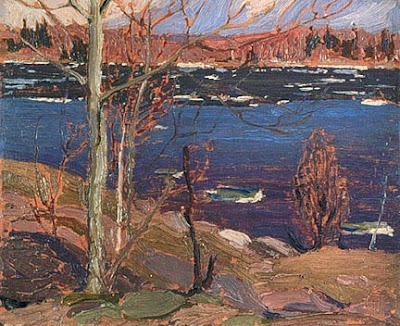
“Eastern Manitoba forest,” by Carol L. Douglas
As our tow truck brought us back into Brandon, an enormous fireball erupted to our right. “Oh, that’s just the airport,” the driver, Gerald Dedieu, said. It turns out that they do firefighting practice there in the off hours.
It was clear that we were going to kill some time in Brandon, so Gerald suggested we head down to his hometown of Souris in our loaner car. Souris has a creek, a suspension bridge, and a pretty setting, he promised us.
"Downtown,"  by Carol L. Douglas

“Downtown,” by Carol L. Douglas
The suspension bridge is Canada’s answer to the Jubilee Memorial Watering Trough. Every town apparently has one, Souris included. Instead of painting that, or Souris’ peacocks, I decided to paint a block of their downtown.
There is some debate about where the geographical center of America falls. It’s either in Rugby, ND, or just east of Winnipeg, MB. It hardly matters. Either way, virtually everyone on our continent is a southerner. Furthermore, most have not ventured north of the true Mason-Dixon Line, which is the 49th Parallel.
Minnesota owns a wee bit of land north of the 49th Parallel, due to a surveying error. The Northwest Angle, as it’s called, is cut off from the United States byLake of the Woods. To get there from the US, you need a boat, an ice bridge, or a passport, because the only roads come in from Manitoba. It’s got a population of 152 people and a land mass of about 600 square miles, of which 80% is water. This being a strictly Canadian visit, we did not detour there.
West Hawk Lake is surprisingly huge.

West Hawk Lake is surprisingly huge.
We did, however, visit West Hawk Lake. This is Manitoba’s deepest lake, at 115 meters. It was formed by a giant meteor, and its size is impressive.
West Hawk Lake is on Historic Route 1, so we ventured up that road looking for a glimpse of history. Alas, it was apparently recently bombed, so broken was the asphalt. We turned back.
"Lake of the Woods,"  by Carol L. Douglas

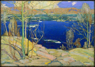
“Lake of the Woods,” by Carol L. Douglas
I set up to paint Lake of the Woods from the Discovery Center at Kenora. It was a great bonus, in my opinion, to have genuine running water and a soda machine at my disposal. Alas, there was a wedding being held there later in the day, so I was shooed along. I relocated a mile or so to the north.
I’ve switched mediums to Galkyd Light, since it’s all I could buy in Calgary. I’m having a hard time adjusting to it. It feels soupy. This is showing up particularly in my mark-making and in water reflections. I was struggling so much trying to find a workable scheme for the water at Lake of the Woods that I forgot to paint in the remainder of the sky.
"Thunder Bay,"  by Carol L. Douglas

“Thunder Bay,” by Carol L. Douglas
Western Ontario looks a lot like the Maine woods: granite and spruces and Jack Pines, and a whole lot of water. I was shocked, therefore, on arriving at Thunder Bay. Growing up listening to Canadian radio, I had always pictured it as a romantic place far west on the Great Lakes. Its waterfront is actually a lot like South Buffalo, which is where my people come from. The same neat workingman’s cottages march down to the same vast grain elevators.
The difference is that Thunder Bay’s grain elevators are still working. That’s because freighters take on grain here, rather than offload it. Today that grain goes right out the St. Lawrence into the world. Buffalo—the world’s first cross-docking station—is unnecessary.
Dusk falling on Lake Superior.

Dusk falling on Lake Superior.
I expected that one Great Lake shore was pretty much the same as another, but I was wrong. Here, red granite tops rough hills that drop to the lakeshore. This exposed granite is part of the vast Canadian Shield that forms the bedrock core of our continent.
As we drove east along the lakeshore, dusk dropped like rose-colored silk. A bear cub gamboled along the shoulder of the road. We were back in moose country. It was time to stop for the night.

Weary and bleary

Scrub oaks along the Assiniboine River at Brandon, Manitoba. It looks a lot like the Erie Barge Canal.

Scrub oaks along the Assiniboine River at Brandon, Manitoba. Up close, it looks a lot like the Erie Barge Canal.
Groaning as I dragged myself out of bed yesterday, I profoundly wished for a day off. My painting is suffering from being overtired and ill with a cold that will not end. But that was not to be: any day off is a day longer on the road. We gassed up and left Swift Current, Saskatchewan, well, swiftly.
My husband suggested that we stay in Winnipeg until Friday to see the Blue Bombers play. As daft a notion as that is in and of itself, it would have put us even farther behind, time-wise. My goal is to be in Ontario on Friday night.
For most of its length, the Trans-Canada Highway runs fairly close to the United States border. That’s where most of Canada’s population is. As we approached the Manitoba line, we were leaving the Palliser Triangle. This region spans the three prairie provinces and continues down into Montana, Wyoming and the Dakotas. Hot in summer, cold in winter, it’s so dry that it doesn’t support trees naturally. However, its soil—a lovely dark chocolate color—is very fertile.
Mysteriously, the telephone poles along the rail line seemed to be sinking.

Mysteriously, the telephone poles along the rail line seemed to be sinking.
Manitoba is the geographical center of Canada and as such marks our halfway point. We began to see scrub oaks and willows along washes and riverbeds. The Assiniboine River wasn’t visible from the road, but it jitters around like the writing of a seismograph needle on the map. I pictured a gentle stream swishing back and forth in an old eroded channel.
At Brandon, we turned off the Trans-Canada and headed north on Route 10, looking for a place to paint. The landscape was suddenly looking very Midwestern. Farms replaced ranches, towns were more frequent, and the tree cover grew more abundant. Golden light poured down onto the newly mowed hayfields.
And then, with a mighty screech, the SUV powered down and refused to move. A turn of the key elicited nothing but a click. It could only be a failed alternator.
This is a view of our car that is getting tiresome.

This is a view of our car that is getting tiresome.
We sat and read silly novels on the roadside while we waited for the Canadian Automobile Association to send a tow-truck. Boy, am I grateful for their international reciprocity, as well as for global roaming on our cell phones.
Even in funny money, this is going to be costly, but at least it will be quick.
Scrub oaks along the Assiniboine River at Brandon, Manitoba. It looks a lot like the Erie Barge Canal.

Scrub oaks along the Assiniboine River at Brandon, Manitoba. It looks a lot like the Erie Barge Canal.
In the meantime, I have a loaner. I drove down to the Assiniboine River. It looked like the Erie Barge Canal.
I’ve gotten my day off, and this is forcing me to take the time to do our laundry. Then forward, and even if I’m cruising through Winnipeg at game time, I refuse to stop and watch the Blue Bombers.

Painting yesterday’s landscape

"Windbreak," by Carol L. Douglas.

“Windbreak,” by Carol L. Douglas.
We’ve traveled 4200 miles playing the game of “those cows are my cows.” (In our family, a herd of cows counts as one, a cemetery kills your opponent’s cows, and a church resurrects them.) Yesterday’s game was particularly cut-throat. It reminded me that I need an eye exam when I get home.
Since we can’t take it through a car wash, the SUV is looking downright geological. The arctic mud has eroded, and a fresh coating of Saskatchewan dust covers everything. A license plate bolt jarred loose and our Maine plate hangs at a rakish angle.
The only company we had while painting the windbreak.

The only company we had while painting the windbreak.
Our current path crossed last year’s at Regina, Saskatchewan. In this area, farms are still being worked, but the old prairie homesteads are abandoned. They are elegiac, and I’ve wanted to paint one since I first saw them.
I saw several on Tuesday, when the wind blew too hard to paint. Because I knew there were some in the Regina area, Mary and I dropped off the Trans-Canada Highway onto local roads.
Mr. Gordon Kish, ghost town owner.

Mr. Gordon Kish, ghost town owner.
From the place names, we realized Saskatchewan has a significant population of French-Canadians, or Fransaskois.
In 1752 Louis de La Corne led an expedition along the northern coast of Lake Superior, through Le Pas, Manitoba and to the forks of the Saskatchewan River. These lands became the most western in the French New World Empire. French fur traders roamed the territory for the following century, establishing families with native women. These people, the MĂŠtis Nation, developed a creole language called Michif, which is a complex blend of Cree and French. Later, French immigration into the area was actively encouraged by Canada.
Neelby's forgotten rail line.

Neelby’s forgotten rail line.
Stubbornly, our route refused to yield any abandoned houses. I decided to paint a windbreak instead. These stately lines of poplars seem curiously formal for the open prairie, but they are hardy and fast-growing.
I sat on a range road for several hours wrestling with the emptiness. I’m not thrilled with my solution. Thinking conventionally, I created foreground interest that’s, simply, a lie. It makes the space seem eastern and small. The painting needs editing, and I’m debating how to do it.
Unfinished painting of Neelby grain elevators.

Unfinished painting of Neelby grain elevators.
I find that as I enter new terrain, I stubbornly see it as a continuation of the prior environment, so gradual is the change. Saskatchewan is flatter and wetter than Alberta. Finally, I stopped and looked at what was actually there. Two abandoned grain elevators in the far distance caught Mary’s eye, and we lurched along a range road to get to them. There was one hour until sunset; I could do a small painting if I concentrated.
A truck pulled up. Gordon Kish, rancher and auctioneer, is the last remaining resident of the ghost town of Neelby, Saskatchewan. In fact, he owns all 220 building lots. Settled in the early 20th century, Neelby had a railroad line and a grain depot, but nearby Kipling was more visionary. It built a reservoir and piped water to the rail line. That made it more useful for steam engines. Neelby faded and died.
Thursday 1

The sun set as we left Neelby forever.
The sun faded as Mr. Kish and I chatted. I was tempted to camp in Kipling and spend another day in Neelby, but I realized I must move on. I have enough information to finish in the studio, however.

I’m not lost

"Coal seam," very unfinished. It's destined for the studio.

“Coal seam,” very unfinished. It’s destined for the studio.
“We are on the fringe of the great North and its living whiteness, its loneliness and replenishment, its resignations and release, tis call and answer, its cleansing rhythms. It seems that the top of the continent is a source of spiritual flow that will ever shed clarity into the growing race of America.” (Lawren S. Harris, 1926)
I was born exactly 144 km from Lawren Harris’ birthplace, and I understand the call of the Great White North as much as Tom Thomson and the Group of Sevendid. Still, I don’t think the Great White North is the beating heart of Canada. That honor must go to its prairies. Immense, they have a deep, diverse economy: oil, natural gas, coal, beef, grain, and wind. Once you’re away from the settlements, they are a land of enormous skies and great emptiness.
Even with easel lashed to SUV, the vibrations made it impossible to paint.

Even with easel lashed to SUV, the vibrations made it impossible to paint.
There are pumping jacks everywhere in eastern Alberta, and they were, in the majority, stilled. Canadian oil is in a bust phase of its boom-bust economy. Still, I wish we would buy whatever oil we cannot produce ourselves from our democratic neighbor to the north rather than from those who wish to harm us.
Atlas #3 coal mine on the Red Deer River.

Atlas #3 coal mine on the Red Deer River.
We set off yesterday to see Canada’s Badlands, promised hoodoos and dinosaur bones by Alberta Provincial Parks. Canada’s badlands are, like its people: nice. They are incapable of raising a frisson of fear. Still, the Red Deer River Valley is particularly lovely, with its fringe of trees golden against the scoured ridges.
Once again, I was flummoxed by the wind. The enormous windmills were making one revolution every three seconds. Parked in the shadow of a cliff, I lashed my tripod to the SUV, and set about painting a small study of a coal seam in the rock. The easel jarred and rattled even with many rocks weighing its base. My medium cup kept flipping over, so I put a pebble in it.
Going about the business of the plains.

Going about the business of the plains.
I wear a ponytail so that my cap doesn’t fly off, but even with that I was wishing for a string to hold it down. An hour later, I’d made very little progress. This painting is destined to be finished in the studio.
Our detour had taken us about 70 miles west, and it was midafternoon before we set off to our second destination: the Great Sand Hills of Saskatchewan. Northwest of the Red Deer River, the land is a little drier and wilder. There is more pasturage and less wheat. The wind ruffles grass the color of a Belgian’s hair in a motion that looks just like whitecaps on Penobscot Bay.
Pronghorn antelope notice our presence.

Pronghorn antelope notice our presence.
The internet is a little vague about how to reach the sand hills themselves, but we had an idea of where they were located, and I’m an inveterate shunpiker. Twice we set out along range roads and tracks in the general direction; twice we were rebuffed when the roads petered out into farm tracks.
That was a costly error.

That was a costly error.
It was not a wasted trip. A coyote loped across the road in front of us. Innumerable waterfowl filled the sloughs. Hawks, magpies and crows perched on fenceposts, waggling as they adjusted their weight to the wind. Herds of prong-horn antelope, startled by our approach, raced away across the prairie.
Prairie cemetery.

Prairie cemetery.
As the sun dropped, we quit our search and headed southeast to Swift Current. The well-head lights shone like fairy lights against the deepening blue twilight.
Today we have vowed to stay closer to the Trans-Canada Highway. All that shunpiking, while beautiful, was unproductive.

Follow my painting adventure across Canada

Last August I drove across Canada and the US to Alaska. This was not primarily a painting trip. I painted only a few watercolors from the passenger seat. However, the journey—remote, fantastical and very wild—fired a desire to do a real painting trip across Canada.
This morning I’m flying to Anchorage to start this dream painting trip. My wingman is my daughter Mary. We’ll be traveling in a fairly ancient Suzuki SUV. How this trip will pan out depends on a number of factors: the roads, the weather, and our endurance. Yes, there will be bears.
I’m bringing 65 canvases. I could finish them all, or a bear could steal my easel. There’s just no telling.
We’ll be driving the northernmost route that is possible this time of year. We have sleeping bags, winter clothes and bathing suits, just in case we find a hot spring.I plan to post as frequently as possible, but internet is spotty way back of beyond. How can you be sure to keep up? Subscribe to my Bangor Daily News blog (not any more, subscribe on the right!), and you will get my dispatches as soon as I file them.

Did I mention there will be bears?

Use your power for good

The Canadian National War Memorial (also known as The Response), was originally built as a WWI memorial. It was designed by British sculptor Vernon March but modified in 1982 and 2000. It is a stunning evocation of wars throughout time.

Because the National Gallery of Canada has one of the world’s largest collections of Group of Seven paintings, I’ve made pilgrimage to Ottawa. It’s a lovely city—beautiful architecture, relaxed pace, and in a gem of a landscape. I was so impressed with it, in fact, that I asked my husband why we didn’t move there. Alas, Canada is not a belligerent nation, so it wasn’t likely he was going to get a job there in the military-industrial complex.
From a lifetime of living on the border, I believe a Canadian is far more likely to talk you to death than shoot you. Canada is safe, kind, dull, and neighborly. That—and hockey—is its brand.
Peace and Liberty stand at the top of the Memorial
When I was writing my essayabout Death of Klinghoffer yesterday, it occurred to me that what the Metropolitan Opera of New York was doing was rebranding itself as edgy and relevant, and in a morally dubious way.  And now that I’m seeing everything through the lens of branding, I wonder about the two homegrown terrorists who attacked Canadian soldiers this week.

The WWI figures on the National War Memorial.
I’ve been thinking in these terms because one of my painting students (and pals) is branding guru Brad VanAuken. We often talk about branding in painting class, and I find it fascinating.
Memorials to all wars were added in 1982.
Yesterday’s Ottawa jihadist has been identified as 32-year-old Michael Zehaf-Bibeau, French Canadian by birth and a recent convert to Islam. He was apparently a “high risk traveller” and had his passport seized to prevent his joining Islamic terrorists overseas. What’s shocking is that Martin Couture Rouleau, who earlier this week mowed down and killed two Canadian soldiers in Saint-Jean-sur-Richelieu, Quebec, was also a disaffected French-Canadian who rebranded himself as an Islamic terrorist.
Memorials to all wars were added in 1982.
 Their personal rebranding efforts are a form of performance art—a fatal form, since you die before you get applause. It only works because Islam itself has succeeded in rebranding itself as a romantic, meaningful alternative for the young male loner. All it takes is a keffiyeh and a gun.
Meanwhile, what does this do to Brand Canada? Canada comes late to most social ills, but it generally gets there, as the stories of Paul Bernardo and Karla Homolka and the École Polytechnique massacre remind us. And then it returns to its innocence, being our good neighbor to the north.
The Tomb of the Unknown Soldier, where Cpl. Nathan Cirillo was gunned down, was added to the National War Memorial in 2000.

Message me if you want information about the coming year’s classes and workshops.

Field sketch to finished painting

Here are two paintings by Tom Thomson which demonstrate how he went from a field sketch to a finished painting. He changes the aspect ratio a bit but it’s blown up roughly 3.5 times in the final work.


“The Opening of the Rivers: Sketch for ‘Spring Ice’” (1915)

oil on wood-pulp board21.6 x 26.7 cm (8.5X10.5 in)


“Spring Ice” (1916)

oil on canvas72 x 102.3 cm (28.3X40.3 in)
Both are owned by the National Gallery of Canada, http://national.gallery.ca/ and displayed on http://cybermuse.gallery.ca/.