Stuck in traffic? Far more interesting to study a river bed than ponder the next rest stop.
 |
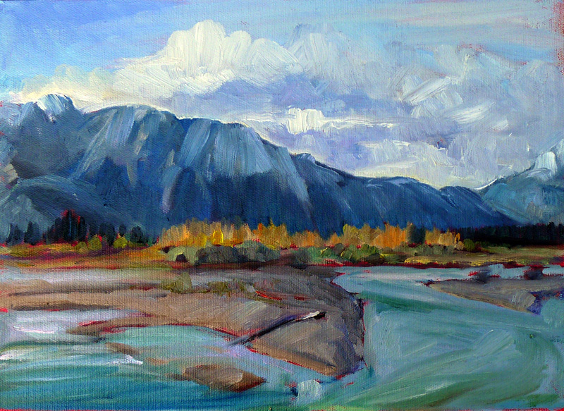
| The Alaska Range, by Carol L. Douglas. The Yukon River, foreground, is a classic braided river. It stretches a mile across, carrying silt… and gold. |
It normally takes about 5 hours and thirty minutes to get from my house in Rockport, ME to my daughter’s house in Rensselaer County, New York. Taking the scenic route—Massachusetts Route 2—adds another half hour. There is the still-more-northerly route 9 through Vermont and New Hampshire.
There are times when even the most experienced road warrior unclenches her hands from the steering wheel and says goodbye to the interstate highway system. I moved to Maine to reduce the time I spent on Interstate 90 between Buffalo and Boston. However, with my daughter’s wedding I’ve been up and down that road too much recently. And I’ll be back on it in 9 days, heading to Rochester to teach a workshop.
 |
| Confluence, by Carol L. Douglas. The Athabasca River is another classic braided river. |
We’d hung around Buffalo waiting for our youngest to finish his finals. A geology major, he finds himself buried in calculus and chemistry instead of thinking about rocks and minerals. Geomorphology is the study of why landscapes look the way they do. Why not think about that on the last leg of our trip home?
East of North Adams, Route 2 climbs into the Hoosac Range via a series of hairpin turns. The vistas into Vermont are fabulous. The road then follows the old Mohawk Trail, a trading footpath that connected the coast with the Iroquois Confederacy. Because pre-industrial commuters weren’t keen on extra climbing, their path ran along the Deerfield River and several of its tributaries. This ultimately dumps into New England’s longest river, the Connecticut.
 |
| River Rocks, Upper Jay, New York, by Carol L. Douglas. The Appalachians deposit their debris very differently from western rivers. |
The drainage system of these small meandering streams, my son tells me, is typical of old folded mountains like the Appalachian Chain. It’s called a trellis drainage system. As the river flows along a valley, smaller tributaries feed into it at right angles, dropping down the steep mountain slopes.
Where the sediment load is high and the slope is low, rivers become braided. They form shifting sandbars and islands, or eyots, as our British cousins call them. There is certainly sand and rock in our small eastern rivers, but for a true braided river you have to go to the Pacific Northwest, especially Alaska and the western Canadian provinces. I’ve painted a few of them.
 |
| Upper Falls, Letchworth, by Carol L. Douglas. This deep gorge is geologically very young, and is cut through shale, limestone and sandstone. |
Unfortunately, the steep valleys of the Mohawk Trail also meant that spring road work cut the pavement down to one lane. The whole trip took us just over eight hours. I’d promised Howard Gallagher of Camden Falls Gallery that I’d do something for him around noon; I finally had the chance to call him at 4:30. “It’ll keep until morning,” he said cheerfully.
Next up—a brace of workshops. The first is at Mendon Ponds in Rochester, NY, June 2-3. That’s followed almost immediately by a watercolor workshop aboard American Eagle, June 10-14. There’s still a small number of spaces available for each, along with my August workshop at Acadia National Park. Email me if you have any questions.