Bigger isn’t necessarily better

Is Draken Harald HĂ„rfagre a realistic transatlantic Viking vessel?

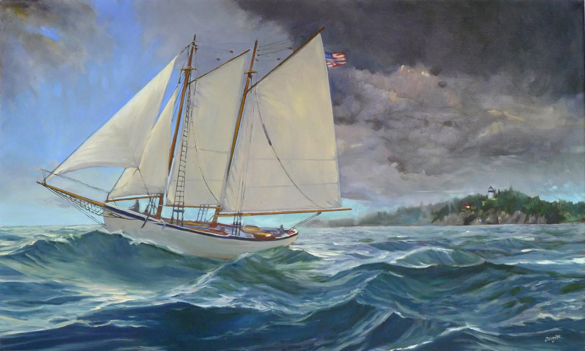
Wreck of the SS Ethie, by Carol L. Douglas. This wreck was in the Gulf of St. Lawrence, not far from L’Anse aux Meadows.

Draken Harald HĂ„rfagre, the enormous Viking ship that crossed the Atlantic in 2016, is stopping to visit Rockland on July 22-25. I’ll go look at it, of course, since I’m interested in the Vikings and their excursions to the New World. However, there’s never been any evidence that such a large ship ever crossed the North Atlantic. It’s the wrong type of boat.

Like modern mariners, the Vikings had different boats specialized for different tasks. The knarr was the cargo boat routinely used for long sea voyages. It was wider, deeper and shorter than a longship. Knarrs averaged about 50 feet in length with a beam of about 15 feet.
Knarrs are sturdier than longboats, and depended on sail-power, using oars for auxiliary power. They were capable of making 75 miles a day and worked the northern reaches of the North Atlantic carrying trade goods and livestock. For that reason, it was probably a knarrthat brought settlers to L’Anse aux Meadowsin Newfoundland.
The Bayeux Tapestry (c. 1070) depicts English and Norman ships in traditional Viking style.
Draken is not a replica of any real vessel. Her hull was built with materials and techniques similar to those used for medieval longships. Draken’s of a class of warship known as a skeid.She is 115 feet long, 26 feet on the beam, draws 8.5 feet, and has a crew of 32 people (chosen from a pool of a thousand applicants). She’s both bigger than the average skeid and carries fewer people.
Archaeologists discovered the remains of several ships in Roskilde, Denmark. The largest was built at Dublin around 1025 AD, near the end of the Viking Age. At 121 feet, it is the longest Viking ship ever discovered. Another was around 98 feet long and carried a crew of 70-80 people.
I’m reminded of this because I regularly drive by a sign in Waldoboro with the town’s motto: “Home of the five-masted schooner.” This is referring to the first such boat built, the Governor Ames. She was the world’s largest cargo vessel at the time she was built, in 1888. The first six-masted schooner, George W. Wells, was built in Camden, Maine in 1900. These boats generally moved lumber and coal. They were built as a cost-cutting measure at the end of the age of sail, but ultimately could not compete with steel ships and railroads.
Lumber Schooners at Evening on Penobscot Bay, 1863, Fitz Henry Lane. (Courtesy of National Gallery).
Of the eleven six-masted schooners built in the United States, nine came from Maine, and seven from the Percy & Small yard in Bath. The Wyoming, built by Percy and Small in 1909, was the largest wooden sailing craft to operate in commercial service, at 450 feet long.
These boats often had short careers. An exception was the lumber schooner Malahat, which enjoyed a good long interlude running rum to San Francisco during Prohibition.
“Schooner ‘Wyoming’ of New York, the largest schooner in the World at the L & H Docks, Pensacola. 93 days from Africa with mahogany. Will now load lumber and turpentine, etc. for France.”
Extremely large wooden boats had a tendency to flex in heavy seas, which caused their long planks to twist and buckle. This in turn let seawater into the hold. A number of them foundered just a few years after launching with the loss of all hands.
The Vikings—the greatest sailors ever—kept the size of the knarr down to what was seaworthy in the North Atlantic.
Draken Harald HĂ„rfagre crossed the Atlantic with a support ship (to film the trip). But I spoke with a former hand after the trip. “Every day, I feared for my life,” she said. I’m not surprised.

If I were younger

I’d join an archeological expedition searching for Old Norse sites in the New World.
The beach at L’Anse aux Meadows. Can you imagine landing a Norse longboat through those rocks? (Photo by Carol L. Douglas)

I do a lot of scrambling around on rocks. Over the past few years that’s become increasingly difficult. Yesterday, I had a cheilectomy on my right great toe. It’s going to be followed by the same procedure on the left foot, although whether I can squeeze that in before my first event of the season—Santa Fe Plein Air Fiestaon April 28—remains to be seen.

Hallux rigidus is not necessarily caused by old age; it can be the result of overuse injury. Me and Shaquille O’Neal, all the way.
Apparently, you can’t just saw off a piece of bone without discomfort. It hurts like hell this morning, so I will do what my doctor ordered, which is to rest and keep it elevated. This is an opportunity to catch up on my reading, starting with some Old Norse news.
Recreated settlement at L’Anse aux Meadows. (Photo by Carol L. Douglas)
Last week, Birgitta Wallace, a senior archaeologist with Parks Canada, told Live Science that she has a pretty good idea where the fabled Viking settlement of Hóp (Vinland) was located. She’s narrowed it down to an area of eastern New Brunswick, bounded by Miramichi and Chaleur Bay.
A straight line drawn between these points is about sixty miles long. A long peninsula extends out between them into the Gulf of St. Lawrence, making her guess an area of several hundred miles of remote coastline. Compared to other estimates, that’s quite specific—archaeologists have placed Hóp as far south as the Hudson River.
The large circle is where Birgitta Wallace believes HĂłp is located.  The small circle is the location of L’Anse aux Meadows.
The only verified Norse site in the New World, L’Anse aux Meadows, was discovered based on just such an educated guess.
According to the Icelandic Saga of Erik the Red, Thorfinn Karlsefni and his company found Helluland (Baffin Island), Markland(somewhere in Labrador), Kjalarnes promonatory, the Wonderstrands(possibly Labrador), StraumfjörĂ°(location unknown) and, finally, HĂłp. This last was a bountiful place, where no snow fell during winter. Not Maine, clearly.
The inhospitable landscape of northern Newfoundland. (Photo by Carol L. Douglas)
Historians had long believed that the Old Norse name Vinland meant that the settlement contained wild grapes. That meant that Hóp had to be south of New Hampshire because, with few exceptions, wild grapes don’t grow any farther north.
Norwegian explorer Helge Ingstad and his wife, archaeologist Anne Stine Ingstad, doubted that theory. They believed the name meant ‘land of meadows.’ Based on Eric the Red’s descriptions, they narrowed down their area of search to the northern arm of Newfoundland. In 1960, they started asking the locals if there were any old Indian sites in the area.
One of the foundations excavated by the Ingstads. (Photo by Carol L. Douglas)
In 1960, local George Decker led them to a group of mounds near the village. Residents had called this “the old Indian camp.” These grass-covered bumps turned out to be the remains of eight Norse houses, dating from 1000 AD and definitively connecting the site to the Icelandic Sagas.
Wallace is back to thinking about grapes. Chaleur Bay means “bay of torrid weather.” It’s warm compared to Maine. Grapes do grow wild there. Wallace thinks that region contains everything described as being at the legendary Hóp: wild grapes, salmon, barrier sandbars and natives who used animal-hide canoes.
Based on the Ingstads’ experience, Wallace should, by all means, scout around the bay. And if she’s successful, it will give me something to read about when I get my other foot operated on.

Detour to Vinland

If you got across the bar, you still needed to beach your boat. L'Anse aux Meadows.

If you got across the bar, you still needed to beach your boat. L’Anse aux Meadows.
The last two days have helped me understand the Homeric sea (Winslow, notthat other guy). At times, the sea boils with startling ferocity against the shoreline. Winslow Homer’s art was in making us believe that the sea is always like this, and in seeing that ferocity as romantic.
When I was a child, what was referred to as Vinland in Old Norse sagas (and by medieval historians) was only imperfectly understood. Controversy still raged over whether the Norse had ever reached past Greenland into North America. Today, we assume that Vinland included Newfoundland and the Gulf of Saint Lawrence as far as New Brunswick. That’s logical but not conclusive. The only confirmed Norse site in Canada is at L’Anse aux Meadows, at the very northernmost tip of Newfoundland.
Imagine beaching a boat through those boulders. L'Anse aux Meadows.

Imagine beaching a boat through those boulders. L’Anse aux Meadows.
Prior to the Norse settlement, there were various other prehistoric people in this part of Newfoundland. However, none of them stayed. The Dorset people were driven out by global warming during the Medieval Warm Period; the Mi’kmaq left because it was too cold. Archaeologists believe the Norsemen eventually left because of the weather as well: extreme cold drove their food sources south.
The sky had cleared but the wind still blew fiercely when we reached L’Anse aux Meadows. The visitor’s center, now closed for the season, was unfortunately set square in the middle of the path. I climbed around the building on its uphill side and hopped the fence to the boardwalk. Mary was aghast and followed me reluctantly.
Reconstructed longhouse at L'Anse aux Meadows.

Reconstructed longhouse at L’Anse aux Meadows.
“I’m not the first person to do this,” I said, pointing out the faint path along the slope.
“If all your friends jumped off a cliff, would you do it too?” she retorted.
I raised that kid all wrong.
The longhouses faced the cove in a gentle curve pointing at the shoreline. I don’t understand how that boulder-strewn coast was navigable by any boat. The reconstructed sod longhouse is remarkably contemporary in feel. It could be a settlement in the Dakotas; it could be a modern earth ship.
A poignant reminder that none of our work here lasts forever.

A poignant reminder that none of our work here lasts forever.
I knew we could make better time returning on a different path. Still, I have a healthy respect for quicksand and sinkholes. Former President George H.W. Bush sank into it up to his armpits in Newfoundland. So when Mary suggested an alternative route with a boardwalk, we decided to be prudent.
That is how we managed to walk in a wide sweep for 5 km trying to get back to our car. It was bracing, but it gave us quiet time to reflect on the Norsemen who were drawn here. What in this bleak and cold landscape, with its buffeting winds and lack of topsoil, seemed attractive to them?
Cow Head boats.

Cow Head boats.
We set off south with time for one small painting. We were far enough north that we could see Labrador, and its peaks were dusted with snow, as were the strange worn mountains at Gros Morne National Park. I set up to paint there, but my easel was blown over before I even got started.
Small waterfalls cascaded down to the road after the storm cleared.

Small waterfalls cascaded down to the road after the storm cleared.
In the end, that was fine. We made it to the ferry terminal as cars were lining up to board. Today is calm and lovely, and I’m heading to the Cape Breton Highlands.

White knuckle travel

The wreck of the SS Ethie is strewn across the beach at Martin's Point.

The wreckage of the SS Ethie is strewn across the beach at Martin’s Point.
The steamer SS Ethie set sail from Cow Head, on the Great Northern Peninsula of Newfoundland, on December 10, 1919. Although Captain Edward English knew that some kind of storm was building, it was the last trip of the season, and he was under pressure to get his passengers home for Christmas.
Within a few hours, the storm blew up into a blizzard. The Ethie was making no progress, burning almost all of her coal just staying off the rocky ledges and bars of the coastline. Captain English knew his ship was lost; his priority now was to get the 92 people on board to shore alive.
Number one thing I am thankful for tonight: I am not on that freighter.
He beached the Ethie just north of Sally’s Cove, in one of the few inlets not barred by reefs or cliffs. His crew sent out a rope, which was picked up by a local Newfoundland dog. A breeches buoy was rigged up to carry the passengers and crew ashore, including a baby girl who rode to shore in a mail sack. There were no fatalities.
The dangers of the Great White North are based in the land itself, in its impossible cold and empty vastness. On the Atlantic Coast, the sea is the force that controls lives. The remains of the Ethie are still strewn along the beach and I wanted to paint it.
Stunted trees in the Gros Morne National Forest. This is the beginning of the Appalachian mountains.

Stunted trees in the Gros Morne National Forest. This is the beginning of the Appalachian mountains.
I hit the road from Botwood before dawn. The remnants of Hurricane Matthew had confounded expectations and run up the Atlantic Coast. Our ferry was canceled. We had an extra 24 hours to use as we pleased—as long as what we pleased was possible in a storm.
Studded snow tires are like an arms race. They work, but they also chew ruts into the road. The water runs into them, causing water to pool and freeze, creating more potholes and ice. The ruts have plagued me since Anchorage, as they make steering difficult.
They also fill with water in heavy rain. In the half light of a storm, they are difficult to track. After several hours, my hands were knotted around the wheel.
The shoreline ranges from ledges to cliffs.

The shoreline ranges from ledges to cliffs.
By the time we reached the Ethie, it was clear I was going to do no painting. Needles of sleet were driven by high winds. I took reference photos and debated my next move.
My friend Annette found me a haven with one of her many relatives. Mary wanted to push farther north to see the Viking encampment at L’Anse aux Meadows. What a dilemma: eat Thanksgiving pie with nice people in warmth and comfort, or push through another 350 km to see a desolate and windswept headland in a storm?
Need you even ask?
It got steadily worse as we went north. Sleet was followed by snow. We saw our first sanders of the season. The wind blew so hard that even the potholes had little waves on them. Crosswinds blew our car sideways. And I learned that hydroplaning and cruise control were a difficult combination.
Trawlers at a boatyard in Port Saunders, Newfoundland.

Trawlers at a boatyard in Port Saunders, Newfoundland.
We stopped in Port aux Choix for our Canadian Thanksgiving dinner: gas station hot dogs and coffee. The clerk, a very lovely woman, discouraged us from heading any farther north. “There’s a lovely B&B down the street,” she suggested.
We slid into St. Anthony behind a sander. Still, I had to put the SUV in 4WD to park it.

We slid into St. Anthony behind a sander. Still, I had to put the SUV in 4WD to park it.
We arrived in St. Anthony right behind a sander. We’re drinking bottled water because of the storm, but otherwise we’re warm and cozy. Tomorrow we will head to L’Anse aux Meadows. Mary is going to tromp around and consider the Vikings. If I’m lucky, the wind will slow down and I can paint.
But I’m absolutely certain we won’t be home by Wednesday.