The world’s friendliest people

In anticipation of Canada Day, let me tell you a story about our kind-hearted, open-handed neighbors.

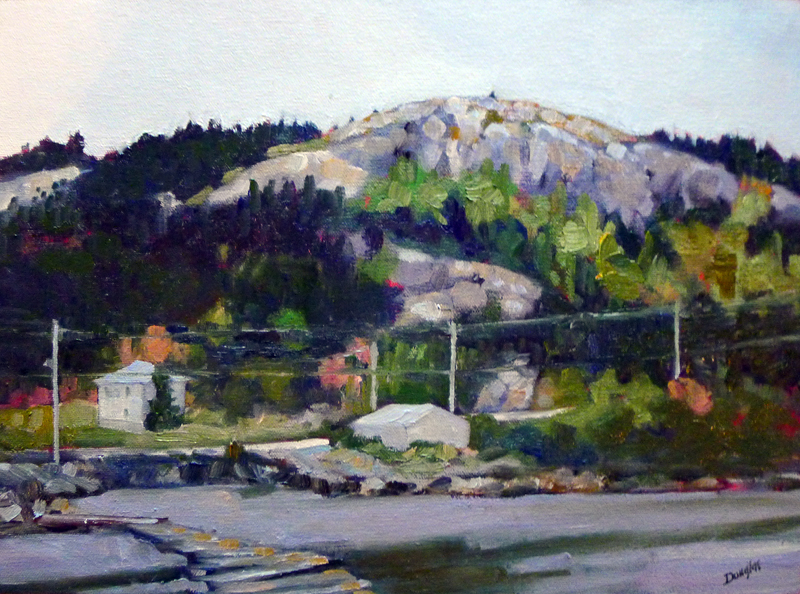
Wreck of the SS Ethie (Newfoundland), by Carol L. Douglas

Newfoundland was the greatest surprise of my Trans-Canada trip. It looks like the Scottish Highlands. That isn’t too surprising, since John Cabot reportedly sailed just 1800 miles west of Ireland to discover it. In geographical terms, that’s next-door-neighborly.

It’s a massive island, and it’s empty; fewer than a half-million people call it home. Other than St. John’s, there’s not a single municipality with more than 25,000 people. Most Newfoundlanders live in small fishing villages strung along the coastlines.
About 300 KM west of St. John’s is the small town of Gander. It’s mainly notable for having gas and a Tim Hortons right on the Trans-Canada. Considering the fantastic landscape all around it, it’s not a place a painter would tarry.
Fog flowing down the mountains near Port-aux-Basques, Newfoundland
Gander exists because of the grandiosely-named Gander International Airport. This was built in 1936, when trans-Atlantic flight was first developing. It’s the easternmost flat point on the North American continent, so it became the fueling point for planes traveling to and from Europe. 
On January 11, 1938, Captain Douglas Fraser made the first recorded landing in a single-engine biplane, a de Havilland Fox Moth VO-ADE.
The town reached its peak during the Second World War, when about 10,000 Allied airmen were billeted there. It was a refueling post for the Royal Air Force’s Air Ferry, which brought American- and Canadian-built planes from North America to Britain. In 1940, it was the largest airport on the planet.
Airman and Infantrymen at RCAF Station, Gander, 1943, Courtesy of Library and Archives Canada 
Eventually jets got big enough to leave from New York or Toronto without refueling, and Gander became just another boom town gone bust.
Until September 11, 2001. Less than an hour after the planes hit the Twin Towers, North American airspace was closed. That left flights in limbo over the North Atlantic. 38 civilian and 4 military flights were ordered to land at Gander. They held more than 6,600 people—two thirds of the population of Gander—and they wouldn’t be going anywhere for a week.
There was only one Customs Officer assigned to Gander. All he knew was that planes had attacked New York and the Pentagon, and we might be at war. He had to vet all those people before letting them loose in Canada. He drafted a planeload of American soldiers to help.
Under a milky sky (Hare Bay, Newfoundland), by Carol L. Douglas
Some passengers were on their planes for 30 hours waiting to be processed. Their only source of news was cell phones. When they finally disembarked, they were not allowed to carry any personal luggage; they left with the clothes on their backs.
Gander has 500 hotel rooms. These were allotted to plane personnel, with the idea that they needed to be rested and ready. That still left more than 6,000 people with no place to go.
Newfoundland and Labrador is the poorest province in Canada, but Gander’s churches, schools, shelters and private homes took in people. The remainder were transported to surrounding towns. Local bus drivers had been on strike, but they put down their picket signs and drove passengers to their destinations.
Cape Spear Road (Newfoundland), by Carol L. Douglas
There wasn’t enough food, bedding, diapers, or formula available for purchase. Citizens opened their own pantries instead. They supplied meals, deodorant, soap, blankets, spare underwear, hot showers and washing machines. The phone company set up phone banks and temporary cable and internet. Citizens even provided entertainment, including whale-watching tours.
Six days later, when airspace was finally opened up, all 6,600 passengers were delivered to the airport on time. Not one person missed a flight.
Canada Day is July 1. This year they are celebrating their Sesquicentennial. We couldn’t ask for better neighbors.

POSTSCRIPT: Michael Fuller of Parrsboro Creative just told me there’s a Broadway musical about these events, called Come from Away. New York readers should check it out!

It’s not that I can’t do it, it’s that I don’t always want to.

The Wreck of the SS Ethie, by Carol L. Douglas.
You all know the Facebook game where artists are asked to post a painting every day for a week and tag another artist each day, right? (The one where, on the fourth day, you forget and never finish.) I love that game. I’m insatiably curious about other artists and their work.
Recently, my friend Elissa Gore played. She posted work from across her career, which has spanned four decades. Her early work was more detailed than her current paintings. That’s no surprise, since almost all of us are taught to paint literally before we learn to paint emotively.
Sometimes people who don’t paint make the error of thinking that non-realistic painting is somehow easier than strictly representational painting, that photorealism is the apotheosis of painting. “That looks just like a photo!” is not, in most cases, a compliment. Art is not about duplicating reality, but learning to step past reality and take your viewers with you.
The multi-colored shingle at Martin’s Point in Gros Morne National Park.
The problem with a subject like The Wreck of the SS Ethie is that it is already playing games with your head. The shingle on this lonely coast in Gros Morne National Park in Newfoundland is wildly-colored. What’s left of the boat is not an elegant wooden corpse subsiding into the surf, but its steel guts scattered down the shore. Simplifying or abstracting in my usual frenetic style would just confuse the viewer.
I love geology almost as much as I do painting. Each year when I do my workshop, I point out the basalt inclusions in Acadia and how they now shape the erosion of the granite bedrock. Sand might be easier on the feet, but rocks are exciting.
At times, rocks can be conveyed as rough, slashing brush strokes, but that only works for ‘normal’ scenes, where your mind can fill in the gaps. For the out-of-the-ordinary, more information is needed. The rocks at Gros Morne have been ground in the surf so hard, they look like they’ve been through a rock tumbler. Many are striped. That requires time and patient attention to detail.

Weathered parts of the Ethie are thrown everywhere.

While I wouldn’t want to paint like that every day, it felt good.

You can read about the wreck of the Ethie and the brave Newfoundland dog who saved her passengers here. I wrote about the abstraction that was the basis for this painting here. And you can read an ode to the wee pup himself here.

Moving on, or moving back

“Under a milky sky (Hare Bay, Newfoundland),” Carol L. Douglas

I’m happy to announce that as of today, Watch Me Paintreturns to Blogspot. I’d like to thank the Bangor Daily News for the past 17 months of hosting. It’s been a great learning experience, and there are many fine blogs on that platform that I read every day.
Astute readers may have noticed that Watch Me Paint has appeared on several platforms for the past five months. This was market research. The modern internet gives us analytic tools simple enough even for an artist to use. I know who visits my website and where they come from. That information supports what the experts say: when all else is equal, host your own blog. It gives you total control of your brand.
My students have heard me speak of group norming in terms of painting. This is when artists who work closely together influence each other’s style. This is the process by which a painting group becomes a ‘school’. It can be a powerful tool for creating new art movements, or it can be repressive.
For painters, it’s important to find working partners interested in the same questions as you are. That doesn’t mean your work will always look the same. For example, even though he was a founding member of the Group of Seven, Lawren Harris ended up being an abstract painter.
Here in Maine, we haven’t been doing much outdoor group painting recently. Meanwhile, my old friends in Rochester have been out every week. They’re having a rare, snowless winter. So I jumped when Bobbi Heath and JoĂ«lle Feldman invited me to join them to paint in the Bahamas next month. Both of them are interested in the same fundamental questions I am: drawing, color relationships and the simplification of landscape. I expect that tropical climate has far different light than I’m used to, and am going to bring a few pigments that I don’t usually use.
I’m committed to finishing my backlog of Canada paintings before we head out. I’m making slow progress, but I’m starting with the least-finished pieces first.
“Grain Elevators, Saskatchewan,” Carol L. Douglas
Yesterday I worked on a painting started in the tiny village of Hare Bay on the northeast coast of Newfoundland. Hurricane Matthew was moving in. There was a milky sky in the deep gloom of fading light. The lighting seemed to fit the mood of this small, poor, isolated town tucked in under an enormous rocky ledge. It wasn’t until I picked it up again in my studio that I felt the oppressive emptiness of the harbor.
The other painting is of a grain elevator in Neelby, Saskatchewan. This was started in a ghost town now owned by rancher Gordon Kish. Again, the light was fading. There is something immensely silent in that hour before twilight, when the shadows are long and every detail is picked out by the searchlight sun. And yet my painting is hardly still. Who knows why?
This morning it’s 12° F in Neelby and 15° F in Hare Bay. While I love field painting more than anything, there’s a time for central heating, too. 

Detour to Vinland

If you got across the bar, you still needed to beach your boat. L'Anse aux Meadows.

If you got across the bar, you still needed to beach your boat. L’Anse aux Meadows.
The last two days have helped me understand the Homeric sea (Winslow, notthat other guy). At times, the sea boils with startling ferocity against the shoreline. Winslow Homer’s art was in making us believe that the sea is always like this, and in seeing that ferocity as romantic.
When I was a child, what was referred to as Vinland in Old Norse sagas (and by medieval historians) was only imperfectly understood. Controversy still raged over whether the Norse had ever reached past Greenland into North America. Today, we assume that Vinland included Newfoundland and the Gulf of Saint Lawrence as far as New Brunswick. That’s logical but not conclusive. The only confirmed Norse site in Canada is at L’Anse aux Meadows, at the very northernmost tip of Newfoundland.
Imagine beaching a boat through those boulders. L'Anse aux Meadows.

Imagine beaching a boat through those boulders. L’Anse aux Meadows.
Prior to the Norse settlement, there were various other prehistoric people in this part of Newfoundland. However, none of them stayed. The Dorset people were driven out by global warming during the Medieval Warm Period; the Mi’kmaq left because it was too cold. Archaeologists believe the Norsemen eventually left because of the weather as well: extreme cold drove their food sources south.
The sky had cleared but the wind still blew fiercely when we reached L’Anse aux Meadows. The visitor’s center, now closed for the season, was unfortunately set square in the middle of the path. I climbed around the building on its uphill side and hopped the fence to the boardwalk. Mary was aghast and followed me reluctantly.
Reconstructed longhouse at L'Anse aux Meadows.

Reconstructed longhouse at L’Anse aux Meadows.
“I’m not the first person to do this,” I said, pointing out the faint path along the slope.
“If all your friends jumped off a cliff, would you do it too?” she retorted.
I raised that kid all wrong.
The longhouses faced the cove in a gentle curve pointing at the shoreline. I don’t understand how that boulder-strewn coast was navigable by any boat. The reconstructed sod longhouse is remarkably contemporary in feel. It could be a settlement in the Dakotas; it could be a modern earth ship.
A poignant reminder that none of our work here lasts forever.

A poignant reminder that none of our work here lasts forever.
I knew we could make better time returning on a different path. Still, I have a healthy respect for quicksand and sinkholes. Former President George H.W. Bush sank into it up to his armpits in Newfoundland. So when Mary suggested an alternative route with a boardwalk, we decided to be prudent.
That is how we managed to walk in a wide sweep for 5 km trying to get back to our car. It was bracing, but it gave us quiet time to reflect on the Norsemen who were drawn here. What in this bleak and cold landscape, with its buffeting winds and lack of topsoil, seemed attractive to them?
Cow Head boats.

Cow Head boats.
We set off south with time for one small painting. We were far enough north that we could see Labrador, and its peaks were dusted with snow, as were the strange worn mountains at Gros Morne National Park. I set up to paint there, but my easel was blown over before I even got started.
Small waterfalls cascaded down to the road after the storm cleared.

Small waterfalls cascaded down to the road after the storm cleared.
In the end, that was fine. We made it to the ferry terminal as cars were lining up to board. Today is calm and lovely, and I’m heading to the Cape Breton Highlands.

White knuckle travel

The wreck of the SS Ethie is strewn across the beach at Martin's Point.

The wreckage of the SS Ethie is strewn across the beach at Martin’s Point.
The steamer SS Ethie set sail from Cow Head, on the Great Northern Peninsula of Newfoundland, on December 10, 1919. Although Captain Edward English knew that some kind of storm was building, it was the last trip of the season, and he was under pressure to get his passengers home for Christmas.
Within a few hours, the storm blew up into a blizzard. The Ethie was making no progress, burning almost all of her coal just staying off the rocky ledges and bars of the coastline. Captain English knew his ship was lost; his priority now was to get the 92 people on board to shore alive.
Number one thing I am thankful for tonight: I am not on that freighter.
He beached the Ethie just north of Sally’s Cove, in one of the few inlets not barred by reefs or cliffs. His crew sent out a rope, which was picked up by a local Newfoundland dog. A breeches buoy was rigged up to carry the passengers and crew ashore, including a baby girl who rode to shore in a mail sack. There were no fatalities.
The dangers of the Great White North are based in the land itself, in its impossible cold and empty vastness. On the Atlantic Coast, the sea is the force that controls lives. The remains of the Ethie are still strewn along the beach and I wanted to paint it.
Stunted trees in the Gros Morne National Forest. This is the beginning of the Appalachian mountains.

Stunted trees in the Gros Morne National Forest. This is the beginning of the Appalachian mountains.
I hit the road from Botwood before dawn. The remnants of Hurricane Matthew had confounded expectations and run up the Atlantic Coast. Our ferry was canceled. We had an extra 24 hours to use as we pleased—as long as what we pleased was possible in a storm.
Studded snow tires are like an arms race. They work, but they also chew ruts into the road. The water runs into them, causing water to pool and freeze, creating more potholes and ice. The ruts have plagued me since Anchorage, as they make steering difficult.
They also fill with water in heavy rain. In the half light of a storm, they are difficult to track. After several hours, my hands were knotted around the wheel.
The shoreline ranges from ledges to cliffs.

The shoreline ranges from ledges to cliffs.
By the time we reached the Ethie, it was clear I was going to do no painting. Needles of sleet were driven by high winds. I took reference photos and debated my next move.
My friend Annette found me a haven with one of her many relatives. Mary wanted to push farther north to see the Viking encampment at L’Anse aux Meadows. What a dilemma: eat Thanksgiving pie with nice people in warmth and comfort, or push through another 350 km to see a desolate and windswept headland in a storm?
Need you even ask?
It got steadily worse as we went north. Sleet was followed by snow. We saw our first sanders of the season. The wind blew so hard that even the potholes had little waves on them. Crosswinds blew our car sideways. And I learned that hydroplaning and cruise control were a difficult combination.
Trawlers at a boatyard in Port Saunders, Newfoundland.

Trawlers at a boatyard in Port Saunders, Newfoundland.
We stopped in Port aux Choix for our Canadian Thanksgiving dinner: gas station hot dogs and coffee. The clerk, a very lovely woman, discouraged us from heading any farther north. “There’s a lovely B&B down the street,” she suggested.
We slid into St. Anthony behind a sander. Still, I had to put the SUV in 4WD to park it.

We slid into St. Anthony behind a sander. Still, I had to put the SUV in 4WD to park it.
We arrived in St. Anthony right behind a sander. We’re drinking bottled water because of the storm, but otherwise we’re warm and cozy. Tomorrow we will head to L’Anse aux Meadows. Mary is going to tromp around and consider the Vikings. If I’m lucky, the wind will slow down and I can paint.
But I’m absolutely certain we won’t be home by Wednesday.

The Night Ferry

"Cape Spear Road," oil on canvas, by Carol L. Douglas.

“Cape Spear Road,” oil on canvas, by Carol L. Douglas.
My Canadian-born neighbor used to tell Newfie jokes. Until Friday, that was all I’d ever heard about Canada’s easternmost province. I’ve wandered around the other Maritime Provinces, but you have to make an effort to get to Newfoundland. It is an eight-hour ferry trip from Cape Breton Island.
Our timing was dictated by the availability of ferry space on this holiday weekend. There are only two trips a day, and today is Canadian Thanksgiving. We decided to drive through from New Brunswick to Nova Scotia to catch the night ferry. We would return on Monday night and pick up our last two provinces on the way home to Maine.
That gave us three days to traverse Newfoundland in both directions. The most sensible thing was to drive straight to St. John’s and work our way back west from there. That means our last three provinces will be done in reverse.
Fog flowing down the mountains near Port-aux-Basques, Newfoundland.
Newfoundland looks very much like the Scottish Highlands and Hebrides. That’s not surprising, since they’re two sides of the same sea. Wind-stunted trees and shrubs cling to granite ridges that drop suddenly to the water. On the other hand, it’s also profoundly familiar, being an extension of the Acadian coastline that runs from Maine through New Brunswick and Nova Scotia.
It’s moose season here. I haven’t seen this many men in camouflage since we left British Columbia. The ferry was full of them. As we waited to disembark, a moose call reverberated across the hold. Around us, men laughed and cheered.
My supply of some paints is almost depleted.

My supply of some paints is almost depleted.
On Sunday morning, Mary dropped me off near Cape Spear to paint while she ran an errand. Cape Spear is the easternmost point in North America excepting Danish-owned Greenland. It is also the site of the venerable (1836) Cape Spear light. World War II bunkers and gun barrels face the ocean.
I was startled to hear a moose bugle, since I wasn’t more than a few miles out of St. John’s. About thirty feet down the road, an animal track threaded back into the woods. When I finished painting, I decided to follow it. There was a remarkable quantity of old bear scat, but at least it didn’t appear to include the remains of plein air painters.
I reached a boggy spot and turned around. The track ended at the shoulder of the road; where did the wee beasties go after they crossed? I noted a disturbance in the gravel and dropped down off the shoulder, only to stop short at a pile of moose entrails and sawed-off legs. They were recent enough to not yet stink.
Encountering a moose or bear is one thing; encountering a hunter when I wasn’t wearing safety orange was another thing altogether. I scurried back to the road, just in time to meet Mary.
At St. John's harbor.

At St. John’s harbor.
St. John’s is the capital of Newfoundland and Labrador. Its commercial harbor is filled with trawlers, freighters, and other working boats. Its streets are every bit as pretty as San Francisco’s, but without all those annoying poseurs who plague California. I swear I saw Queen Elizabeth’s body double leaving church in an emerald green coat and matching hat.
Street after street of colorful row houses in St. John's, Newfoundland.

Colorful row houses in St. John’s, Newfoundland.
We headed east and north. At Hare Bay, a great rock promontory rises behind a modest village. This is everything I love to paint, and I set to it with a will, trying to capture as much as I could before we lost our light.
A local woman—born in this village and now sunk well into middle age without having ever left—stopped to chat. This is actually unusual in Canada, where people seem more reticent to interrupt strangers. In the waning light, I saw a mink swim toward shore. She and Mary tried to find it, but it was too fleet for them.
Hare Bay (unfinished), by Carol L. Douglas.

Hare Bay (unfinished), by Carol L. Douglas.
There seemed to be more cars than usual. “Everyone here goes to church on Sunday evening,” she told us. As we left town we noticed that each church was indeed lighted and full of people. Living here, they have much to be thankful for.